Does the useFloatingOrigin work with vertices of lineMeshes or do I still need to update them manually to the camera origin?
hi @SkySaac welcome to the forum! lineMeshes use the same world/viewProjection matrices that are offset in floatingoriginmode so the feature should work without any updates on your end. if you are seeing different behavior please do share a playground link and I can investigate 
Wanted to chime in and say thanks for this post, and to the developers who made it. It has allowed my world-space cesium project to advance, and not look like lumpy shaking blobs.
I’d like to use this thread to ask whether you expect floating origin to impact deterministic multiplayer sync, particularly in cases where different clients may recenter on different frames. Is the calculation semi-unique per client/engine?
Also, here is a PoC that uses the useLargeWorldRenderingfeature.
The demo I posted is of the moon, but this works with google 3d photorealistic tilesets and the view is pretty amazing! Reach out to me for that demo, because its got a strict quota on it.
5 Likes
@techtruth You’re very welcome, glad to hear you’re enjoying the feature!
The offset is applied on a per-scene level based on the scene’s active camera’s position. So within given engine, each scene can have different offset. So with that in mind, multiplayer sync should be supported assuming each client has unique scene / active camera. If not answering your question please share more details and I can try to further help!
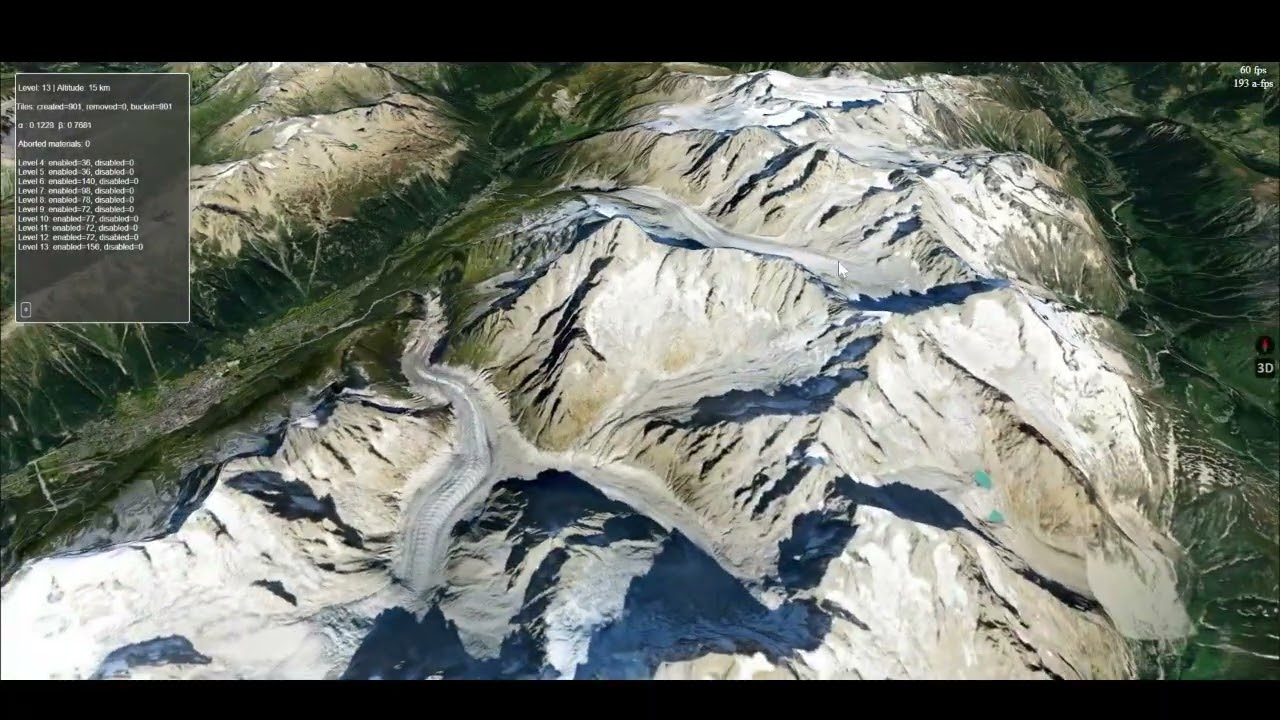
Just a small update on the large world rendering feature.
I now have global elevations working! There is still a lot of stuff to fix and optimize, but it’s getting there !
11 Likes
Looks so good!
2 Likes
So cool !!!
1 Like


Looking forward to it, hope it will be released soon
1 Like
is the 3d tiles are coming from Cesium or directly from google map photorealistic 3d tiles?
Hey,
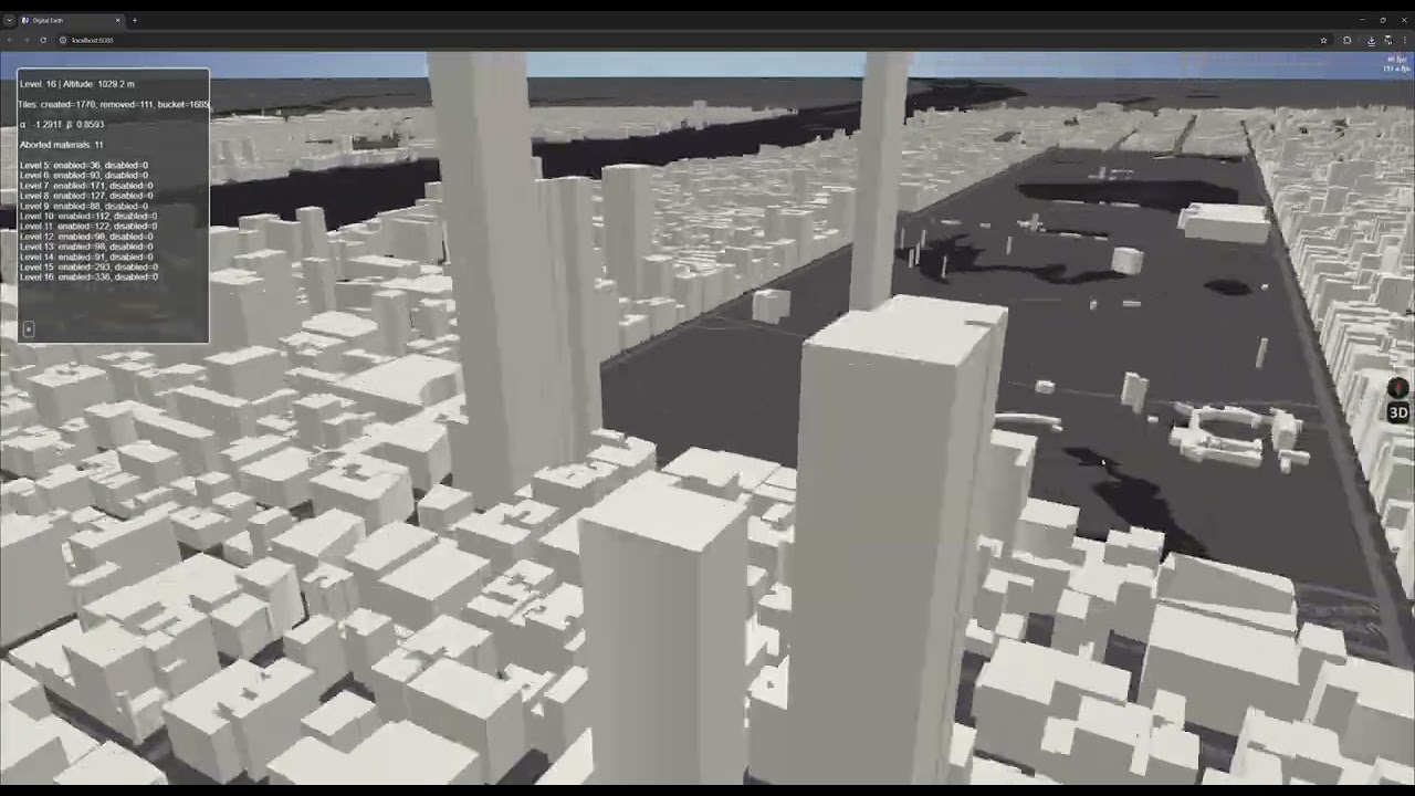
The map tiles are either from Esri or Google (can’t recall which), and the building data is sourced from OpenStreetMap. Elevation data from mapbox.
Friday short clip 
I’m not yet streaming the building topography (it takes about 20-30 seconds to parse & build the city blocks for now (100mb json), Babylon.js still gets the job done 
9 Likes
Hey all! I have officially removed the @experimental flag from the API as the feature is stable.
I have also recently added support for havok + floatingOrigin so that you no longer need to manually offset mesh positions in order for physics to work in large worlds. Havok FloatingOrigin Multi-Region Support. See this thread.
Please do test out in your projects and let me know if you run into any issues!
Will work on documentation ahead of our release
6 Likes
Also worth noting 2 other Geospatial Features that are being announced in 9.0 and are available today, GeospatialCamera (useful for navigating global views centered at world origin) and the NASA-AMMOS 3DTilesRenderer powered by Babylon (one option for loading 3D tiles into your babylon scene)
Will be working on documentation for these as well
11 Likes

5 Likes
This will be a new starting point for BABYLONJS to become the largest 3D library
2 Likes
@georgie Impressive! I didn’t realize how massive this undertaking was…
1 Like
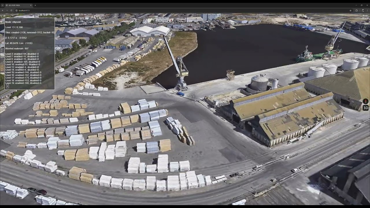
@georgie’s last post tempted me to try out google 3d tiles in my app. Really cool stuff! No streaming yet, still very hacky, and left-handed.
6 Likes
Really nice !!
I’ll start a thread in demos later, but wanted to quickly post a link here with a pre-release peek at a demo showcasing large world rendering. Feedback, opinions, and all that welcome!
2 Likes